Free Great Lakes Watersheds Map
Posted September 27, 2025
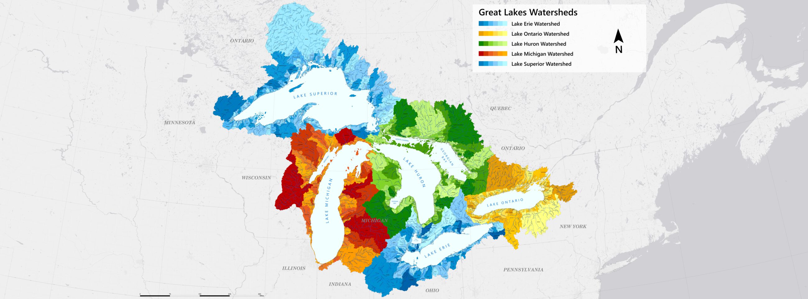
We like to say that everyone lives on waterfront property. This is because everything people do on land – no matter if it’s located on a river or lake or not – ends up in one of the Great Lakes. To illustrate this, we worked with The Nature Conservancy to create a new map of the Great Lakes. The map color codes every drainage basin (watershed) in our region and demonstrates that no matter where you are located, you are in a watershed. A watershed can be as small as a few acres draining into a farm pond or as large as several thousand square miles for a major lake, such as one of our Great Lakes. For example, on this map, all the different watersheds for Lake Huron are a shade of green. All the water – clean and polluted – which flows into all those green watersheds eventually flows into Lake Huron. We hope this map also communicates why it’s so important for all of us – individuals, businesses, institutions, and governments – to be stewards of the Great Lakes. Everything we do on our land matters. To learn how you can become a better steward, contact your local watershed organization in the United States or conservation authority in Canada. Complete the form below to receive a complimentary 3 ft. (W) x 2 ft. (H) printed map from the Fred and Barbara Erb Family Foundation. Maps are printed and distributed on a monthly basis.
2,737 people have claimed this freebie
Order NowYou'll be taken to an external site to claim this offer.
Reviews & Comments
No reviews yet. Be the first to share your experience!